Argentina: Jujuy Province – March 19 – 23, 2017
Trip Plan
This is my fourth visit to Argentina. On my first grand tour of South America with Lillian, my best friend in 1989, we visited Buenos Aires and Iguacú Falls. In 1999 I visited the Moreno Glacier and disembarked in Ushuaia after my first Antarctica trip. After my second trip to Antarctica in 2015, I visited El Chalten and El Calafate. This time my focus is on Northern Argentina including the Quebrada de Humahuaca in the Jujuy Province, Salta and Mendoza before returning to Hong Kong from Buenos Aires.
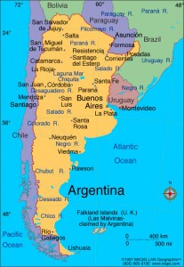 Argentina with an area of 2,780,400km² divided into 23 provinces and an estimated population of about 45 million, is the eighth largest country in the world and the second largest country in South America. While the earliest recorded human presence in the area dates back to the Paleolithic period, the country has its roots in Spanish colonisation when it became a Spanish overseas viceroyalty in 1776. The country declared and fought for independence between 1810 and 1818. After independence, it was embroiled in civil war that lasted till 1861. Massive waves of European immigration since late 19th century has reshaped its cultural and demographic outlook. By early 20th century Argentina became the seventh wealthiest developed nation in the world. Nonetheless, it has gone through periods of instability politically and economically since 1930s.
Given its rich natural resources, it has developed a fairly diversified economy (2016 estimate: 30.2% of GDP from industry; 11.4% from agriculture and 58.4% from service). Today, it is classified as a high-income economy with a GDP (PPP) and GDP(PPP) per capita (2016 estimate) of $880 billion and $20,170 respectively. It is a member of the G-20 major economies.
Argentina is divided into seven geographical regions with rich biodiversity. The regions include the Northwest (high Puna with high and rugged topography, arid pre-cordillera and mountainous Yungas jungles); Mesopotamia (a subtropical wedge); Gran Chaco (a large subtropical and tropical low-lying alluvial plain between Mesopotamia and the Andes); Sierras Pampeanas (a series of medium-height mountain chains located in the centre east); Cuyo (a basin and range area in the central Andes piedmont, to the west); Pampas (a massive and hugely fertile alluvial plain located in centre east); and Patagonia (a large southern plateau to the east, with moister cold grasslands to the south and dense sub-antarctic forests to the west).
![carte_voyage_jujuy[1]](http://www.sarahontheroad.hk/wp-content/uploads/2017/04/carte_voyage_jujuy1-205x300.jpg) Argentina is highly urbanised with over 90% of the population living in cities. It has a well-developed transport system including railway, roads and waterways. Its total road network of over 231,000km serves even more remote parts of the country. Given its stunning landscape and scenery, rich biodiversity and culture, it boasts nine World Heritage Sites(five cultural and four natural sites) which are all fairly easily accessible. It is the top destination in South America with 5.57 million international tourist arrivals in 2013.
Argentina is highly urbanised with over 90% of the population living in cities. It has a well-developed transport system including railway, roads and waterways. Its total road network of over 231,000km serves even more remote parts of the country. Given its stunning landscape and scenery, rich biodiversity and culture, it boasts nine World Heritage Sites(five cultural and four natural sites) which are all fairly easily accessible. It is the top destination in South America with 5.57 million international tourist arrivals in 2013.
The majority of the Argentines are Catholic (76.5% of the population). Former Cardinal Archbishop of Buenos Aires, Jorge Mario Bergoglio, a Jesuit, was elected Bishop of Rome and Supreme Pontiff of the Catholic Church in March 2013. He is the first Pope from South America.
March 19 Sunday: San Pedro de Atacama, Chile to Tarmacadam, Argentina (410km)
I bought a bus ticket from San Pedro de Atacama, Chile to Salta, Argentina. I was on the way shortly after 9am and arrived at the border around 11am. I am now familiar with the terrain and scenery of the Altiplano with mountains between 5000-6500m and salt pans. As our bus was the first to arrive, we did not have to wait long for clearance. While waiting in a queue in the immigration hall, I looked at a large map of the region on the wall. An idea flashed across my mind: I should get off in Purmamarca (2192m) instead of Salta and explore Quebrada de Humahuaca on my own. Many tourists would visit the area on a day tour from Salta.
At 12:30pm, we re-boarded our bus which drove along Ruta 52. The landscape and colours on the Argentine side began to change. The mountains are lower and the terrains look greener and greener. Then Ruta 52 cut across the Salinas Grandes which looks surreal and beautiful.
 |
 |
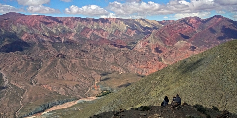
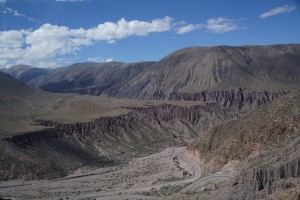
The bus began to climb before descending some 2000m into the spectacular Quebrada de Pumamarca at the end of which lies Pumamarca. Gigantic cactus began to appear on the slopes. The valleys and ravines sculptured by nature is grandiose and stunning. I am also impressed by the conditions of roads which is well-paved and maintained.
 |
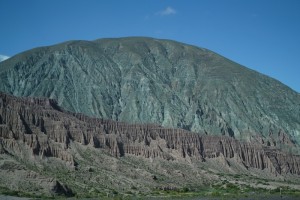 |
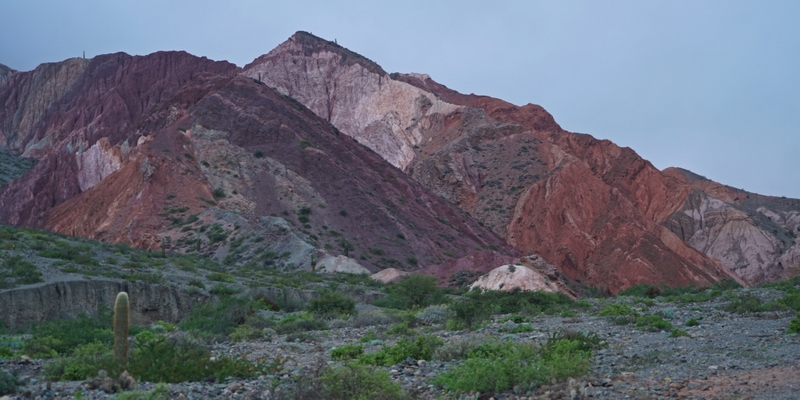
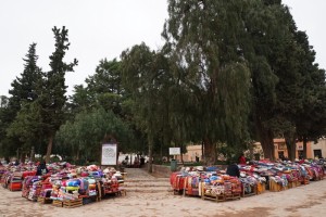
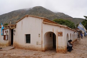
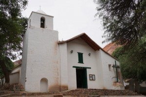
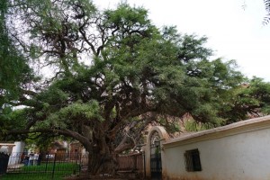
Purmamarca at an elevation of 2324m lies 65km from San Salvador de Jujuy, the provincial capital and 22 km from Tilcara. At the foothill of the Cerro de los Siete Colores (Hill of the Seven Colours), it is the starting point of a number of hikes in the area and one of the most picturesque villages in the Quebrada de Humahuaca. Surrounded by artisan stands selling all kinds of tapestries, hand-knitted clothing, artwork, sculptures, pottery etc, the town square and an old church with a 700-year-old tree in the courtyard, are charming and beautiful.
Around 3:30pm The driver dropped me off on the main road (but not the bus terminal at the town centre). When I saw a hotel, I went in but found it too pricy i.e. over $100 a night. The next one I passed by was La Reliquia which offers camping, dormitory and private rooms. Though I preferred something better, I decided to take a room so that I could get rid of my bags and start sightseeing. I paid Argentine peso (ARS) 450 for a basic private room with three beds! As I had no peso, I paid $30 instead.
Five minutes later, I went out heading to the coloured hills behind the village. A lady showed me the path to a viewpoint which entrance fee is ARS 5. When I told her I had no peso and had to find a money changer first, she gave me ARS 5. “I am from Switzerland and ARS 5 is nothing”. I appreciate her kind thought though the amount is indeed insignificant.
 |
 |
 |
 |
It was very windy and the sun was going down fast. It was chilly and I had to return to my room to put on a coat. Then I spent a while to find a cambio and got ARS 15.5 for $1. I had an early dinner and had llama with rice, carrot and tomato. But the meat was tough. I was tired and went to bed early.
March 20 Monday: Purmamarca – Tilcara
The Quebrada de Humahuaca, a 155km-long narrow mountain valley bordered by the Altiplano in the west and north, by the Sub-Andean hills in the east and by the warm valleys in the south, is a World Heritage Cultural Site. The name ‘quebrada’ means a deep valley and Río Grande flows through the valley in the summer. The region populated for at least 10,000 years, has always been a crossroad for economic, social and cultural communication. It was a caravan road for the Inca Empire in the 15th century, an important link between the Viceroyalty of the Río de la Plata and the Viceroyalty of Peru and a stage for many battles of the Spanish War of Independence. About 1660km from Buenos Aires, this area is known for its coloured mountains, its towns and ruins.
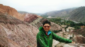 I had a good sleep and got up early. I was keen to watch the coloured hills being lit up by the rising sun. Unfortunately, it was cloudy. I followed the path running next to the hills and met only two locals walking their dogs. I saw a path leading to the ridge which should afford a fantastic view. Though it is not high, the path to the ridge is steep and very narrow. A slip could be fatal especially no one would come to my rescue. I stopped half way up. Soon two young men arrived: they were driving around looking for a place for a panoramic view and spotted me from a distance. I suggested them walk to the ridge and they did. With them around, I was ready to take the risk and reached the top without problem. Excellent views! Though they were in a hurry to drive back to Salta to return the hired car, they stayed around till I descended safely. I appreciate their thoughtfulness.
 |
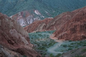 |
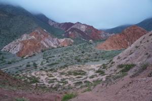
I returned to La Reliquia for breakfast. Before leaving for Tilcara, I walked up a hill on the other side of the main road so that I could have a panoramic view of coloured hills and the village. Though the light was not perfect, it’s still a fantastic view!
I took the 11:15am bus to Tilcara (ARS 17) and found my way to the Hostel Club Tilcara not too far from the terminal. The place is clean, airy and cozy! I paid for a bed in a female dormitory with high ceiling (ARS 180) but ended up having the whole room for two nights!
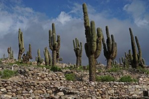
Tilcara (2461m above sea level) was inhabited for over 10,000 years. The fortified town (pucará) was originally built by the maguaca tribe who settled in the area around the 12th century. At its peak, the pucará covered up to about 15 acres with over 2,000 inhabitants living in small square stone buildings with low doorways and no window. By 15th century, the tribes of the Quebrada were conquered by the Incas who used the pucará as a military outpost and to secure the supply of metals which were mined in the area. The Spanish arrived in 1536 and founded the modern town of Tilcara in 1586. Today, the partially reconstructed ruins of the pucará is a major attraction.
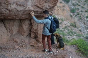
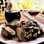 I went to the Tourist Office which suggested me visit the Pucará and the Gargante de Diablo (Devil’s Throat) on my own and join a guided 4-hour walk to see to some tunnels and caves at a cost of ARS 220. It worked out perfectly: I had time for a llama steak in a nice restaurant and red wine (ARS 200) before joining the hike at 4pm.
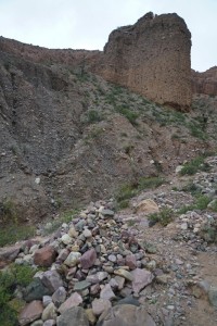
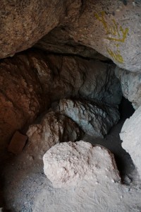
I set off after 4:15pm with three young Argentine guys and a local guide who speaks only Spanish. Sadly I cannot understand the language despite after having taken 30 hours of private lessons. It was a longer walk than I had expected and I was trailing behind. Unluckily I made to the top (about 2750m) without problem. On the way, the guide showed us the practice of offering coca leaves and cigarettes to Pachamama (mother earth). He also poured some liquor over the pile of stones. Then we arrived at the first tunnel which is about 300 metres long. It is very narrow at the entrance: we had to move forward sideway. It was totally dark and we placed lit up candles as we went along. An interesting experience.
 |
 |
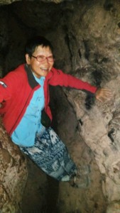 |
Next we climbed up further to reach another cave. This time we had to crawl in. The tunnel is not long nor dark with light coming from the other end. We climbed out of the cave on the other side where we had fantastic views of surrounding coloured hills. I had left my SLR camera outside and the battery on my mobile phone allowed me only to take a photo. So I had almost no photo on my tunnel walk.
 |
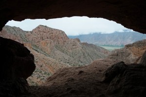 |
After 15 minutes’ rest, we crawled out of the cave and began our descent. One of the guys asked about my age. He was surprised to find me older than his mom!
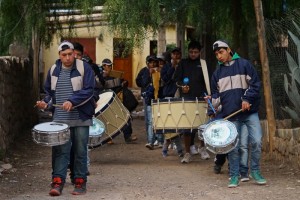
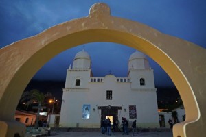
We were back in town at 7:30pm. Our guide joined his friends to play in a band which was on a procession that evening. I did not know what was going on but followed the band to the cathedral. A mass was on and I was told the priest and church-goers would follow the band and walk through the town after the mass. It was cold and wet: I was too tired to hang around for an hour. I did not bother to eat and returned to the hostel shortly after 8pm.
 |
 |
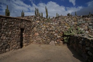
I had a leisure day and did not set off till 10:30am. I walked to the Pucará which is about two kilometres from the hostel on the other side of the Huasamayo River. The entrance fee of ARS 100 also includes a visit to the archaeological museum in Tilcara. A booklet with explanations about the history and the layout of the fortress is provided. A film in Spanish is screened in the visitor centre. I cannot understand why the subtitles are also in Spanish. Anyway, I enjoyed strolling aimlessly in this pre-Inca fortress which occupies a strategic location in the valley. The unobstructed views of the surrounding coloured mountains, ravines and the valleys are magnificent. I could trace the path I had taken the day before to reach the two caves.
 |
 |
 |
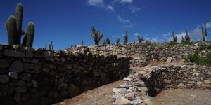 |
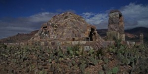
I had to lower my head or walk sideway to enter some of the stone houses. At the highest point at 2500m is a monument erected in memory of Juan Bastista Ambrosetti and Salvador Debenedetti who discovered the ruins in 1908.
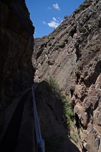
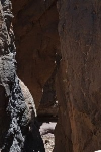
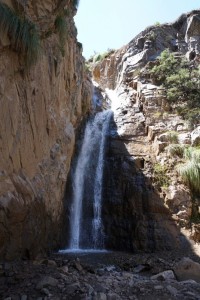
I spent over an hour in this lovely site before heading to the Garganta del Diablo (Devil’s Throat) located at the upper part of the Huasamayo River. It is a canyon, a geographical feature formed by the movement of Teutonic plates. I walked slowly up to an elevation of 2890m before taking a steep path down to the gorge which is so narrow that I could hardly take a photo that can capture its dimensions properly. Then I walked along the stream to reach a natural waterfall which requires crossing the stream 14 times in 20 minutes! I had my feet dry till the last two jumps on my way out.
 |
 |
 |
The walk back to Tilcara is easy. I was lucky to reach the hostel before it started to rain. Though I was hungry, I did not venture out till it stopped raining.
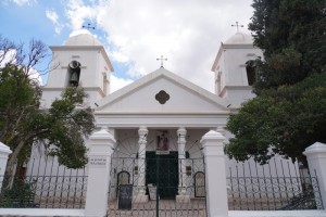
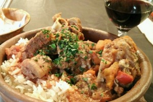 First, I went to the Archaeological Museum which has half a dozen of display rooms. The artifacts are neatly laid out with explanations in Spanish. Luckily I have an idea about the excavation after the morning visit. Next I returned to the cathedral which was now empty and dark.
Cold and hungry, I tried to find a restaurant that was open. I found one and had a nice soup with meat and ¼ litre of wine. There was so much meat that I could hardly finish it. For the next few days, I dared not touch meat again! I paid only ARS 145.
March 22 Wednesday: Tilcara – Humahuaca – Hornocal – Humahuaca (95km)
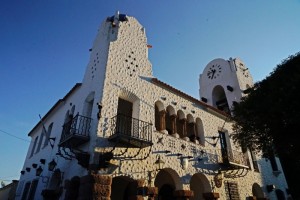
Humahuaca (an elevation of 2939m above sea level and 44km from Tilcara) is the principal town of the Department of Humahuaca, with a population of over 11,000 inhabitants (2001 census). Most visitors stop here on their way to see Hornocal, a range of 14-coloured mountain and Iruya. The main attractions in town include a monument in honour of Heroes of the Independence, a church and a beautiful square.
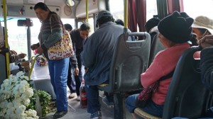 Most tourists take the express bus to Humahuaca which takes around 30 minutes. I took the 8:30am bus (ARS 35) which turned out to be a local one. I was the only foreigner on the bus and the journey took an hour. I was not in a hurry and enjoyed the ride: I looked at the scenery and watched school children getting on and off the bus and a lady bringing two huge bunches of carnation and chrysanthemum to sell in Humahuaca.
I found Hostal Sonada through internet which has good reviews. After some bargain, I paid ARS 1100 for two nights. The manager suggested me take a shared taxi (ARS 200 pp) to a viewpoint to see Hornocal. I followed his advice but had to wait half an hour for a 4×4. I was delighted to find Valarie and Emmanuel from Ushuaia whom I met the day before sitting in the back row. The driver picked up another young lady from a hostel. Four of us finally set off at 11am.
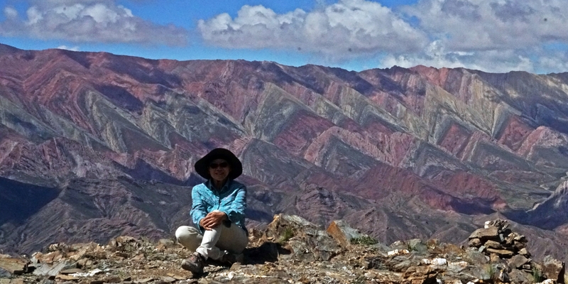
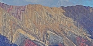
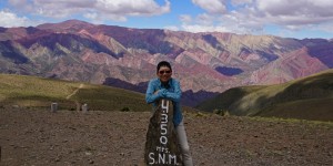
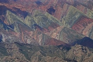
It’s noon when we arrived at a car park (4350m) where we could see the colourful Hornocal mountain range in a distance (I cannot tell how far Hornocal is away in a straight line. 20km or more?). To get a closer look, we walked downhill for over a kilometre to reach a viewpoint which affords fabulous panoramic views. I could see the river below with eerie copper green colours, a lower mountain range with volcanoes and the whole range of Hornocal which reaches an altitude of 4761m.
 |
 |
 |
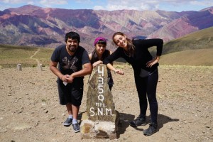 |
The landscape and setting are stunning and breath-taking. It’s amazing to see a dozen of slanting coloured triangular slabs folded up neatly like a napkin. I have never seen this formation on such a scale in my life. The hues are vivid and most impressive. Photos I have taken hardly do justice to what I have seen.
We all sat in silence staring unbelievably at the colours and shapes of the coloured mountain. I wished I had joined a hike that would take me to this mountain range. I did not want to leave but had to go after spending for over an hour at the viewpoint!
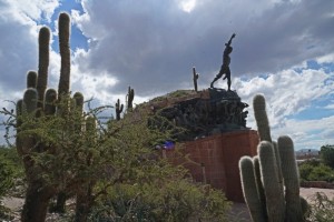
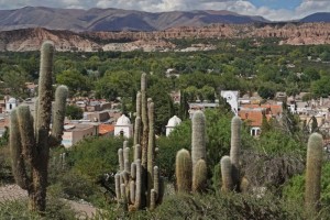
It was after 2pm when we were back to Humahuaca. My young friends found a local eatery with set lunch for only ARS 50. I treated them with a beer which cost the same amount. After saying good-bye to my friends, I walked to the plaza and visited the Monument of the Heroes of the Independence which affords a great view of the valley, the cemetery, the city hall and the church.
 |
 |
 |
 |
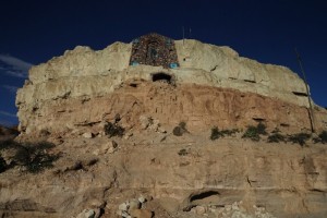 I changed some money ($1 to ARS 15.4) in one of the shops. I was lucky to reach the hotel before it started to rain. Time for an afternoon nap. It stopped raining by 6pm: I took a walk to Peňa Blanc (white rock) about 2 km from the river. Nothing special.
Though I was not starving, I would like to have something nice. Eventually I found a decent restaurant and had a light 3-course vegetarian dinner with egg plant and cheese as starter and a quinoa soup as the main course. I paid only ARS 100: it’s one of the best meals I had in Northern Argentina.
March 23 Thursday: Humahuaca – Iruya – Humahuaca (150km)
Today, I made a day trip to Iruya, a small town at an elevation of 2780m above see level with a population of about a thousand. Located over 300 kms from the province capital of Salta, this village is nested in an isolated location accessible by the unpaved Road 133. Visitors often hike from Iruya to San Isidro eight kilometres away.
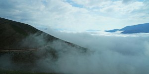
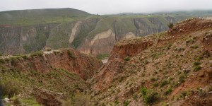
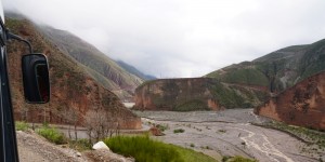
Juan, a retiree from Cadiz, Spain who stayed in Hostal Sonada, also took the 8:15 am bus to Iruyu. He speaks English and becomes my translator and Spanish teacher. We were on Ruta 9 which runs through the Quebrada de Pumamarca before turning off to take the unpaved Road 133 for the next 50 kilometres. According to Juan, we reached the highest point at around 4000m before descending into a river valley with spectacular ravines. Another scenic ride! But I did not take many photos as the road was bumpy and I was not on a window seat.
 |
 |
 |
 |
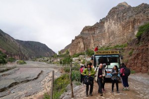
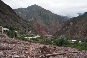
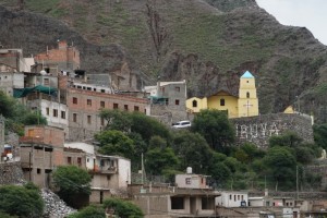
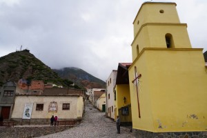
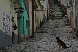
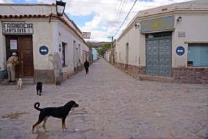
We arrived at Iruya after 11am. It was a cloudy day. The most picturesque view is my first sight of the village when the bus was descending into the river valley. The yellow church, cobble stone streets and rows of rustic old houses are photogenic.
 |
 |
 |
 |
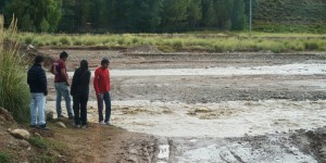
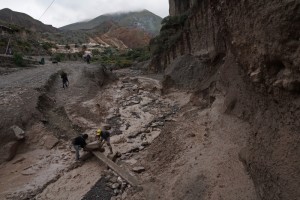
It’s impossible to hike to San Iridsor and be back in time for the 3:15pm bus to Humahuaca. I therefore spent four hours in Iruya. As a result of torrential rain the day before, many footpaths were swashed with stones and mud. Half a dozen of labourers were working hard to put in place a crossing over a stream and clearing mud and stones from the village. Another man was busy getting water out of his house. A few policemen were visiting villagers to check the extent of damages.
 I walked across the stream but got my feet deep in mud! I should have followed the footsteps of the locals. Anyway I could not walk more than 100m as mud was everywhere. I returned to the centre of the village and walked uphill to a viewpoint. As it’s a grey day, I did not find the scenery and landscape as stunning as described in promotional materials. Here I met Valeria and Emmanuel from Ushusia for the third time! What a small world!
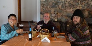
There is not much to do in the village. So I went to Hotel Iruya the best hotel in the village for lunch. Juan and Martin from Buenos Aires were also having lunch in this stylish hotel. I am surprised that a single room with breakfast costs less than $100. Had I stayed here for a night, I could have made my way to San Iridsor.
 |
 |
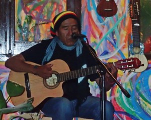
The bus departed on time and I was back in the hotel shortly after 6pm. Juan who loves music, has found a pub with a band playing Andean music. He took me there at 9pm before having a light dinner in local restaurant near the plaza. I hurried back to the hotel at 11pm as I had to catch an early bus the next day. Juan is a night person: he returned to the pub for more music!
 |
 |

