Kars, Ani , Van, Lake Van & Tatvan July 7 – 10
Day 3 Friday: Erzurum – Kars – Ruins of Ani 220km
Today was a relatively easy driving day for Sabahhatin. We were in the high and flat plateau region. The soil is fertile and productive.
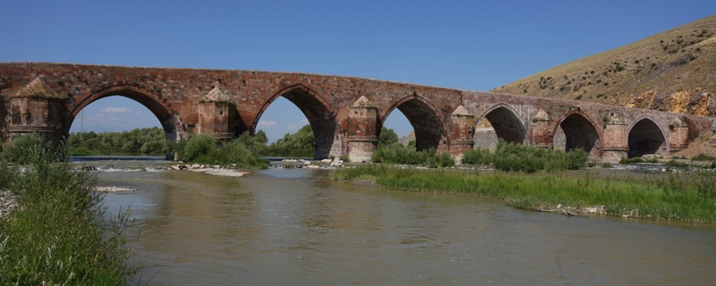
We stopped at the Cobandede Bridge situated at the meeting point of two tributaries of Aras River. The 130m-long bridge with seven arches was built in the 13th century with rocks of three different colours (black, red and gray). There are eight chambers in the abutments.
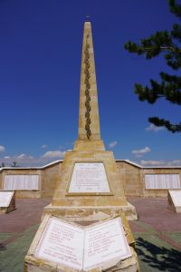
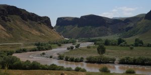 The next stop was a memorial in Sarakimis dedicated to thousands of soldiers who died during the war with the Russians around the city in late December 1914 to January 1915. The number of Turkish losses is estimated to be 60,000 – 80,000. The majority of Turkish soldiers died owing to inadequate winter clothing and field shelters during the attack and retreat. This was where a major military disaster for the Ottomans that resulted in the Russian occupation of Erzurum and Trabzon and later Van and Bitlis.
We had a most tasty okra (ladies’ finger) soup with fresh bread for lunch in Kars. Then we drove to Ani which lies some 47km west of Kars at the border with Armenia. Both Kylie and I dozed off when an incredible accident happened: two small birds hit the wind screen simultaneously resulting in two cracks! It happened so quickly that Sabahattin only saw the bird hitting on the right side of the screen. He could not understand why this would cause a second crack on the left side till he got out of the car to discover another bird had hit at the left side at the same moment. Suicide bomber birds!
We spent over two hours at the archaeological site at Ani, a World Heritage Site.
Brief History of Ani
Ani is a widely recognised cultural, religious and national heritage symbol for Armenians. Ani was the capital of the Bagratid Armenian kingdom (961-1945) which covered much of present-day Armenia and eastern Turkey. It attained the peak of its power during the reign of King Gagik I from 989-1020. Standing on various trade routes, Ani was prosperous and became one of the biggest cities in the world with a population of about 100,000. Nothing in Europe could rival this “City of 1001 Churches” in terms of either size or magnificence in the mid-10th century. Its numerous religious buildings, palaces and fortifications were amongst the most technically and artistically advanced structures in the world.
Following the demise of dynasty, Ani became part of the Byzantine Empire in 1046 only to be captured by the Seljuk army in the same year. In 1072, the Seljuks sold Ani to the Shaddadids, a Muslim Kurdish dynasty. The Christian Georgians captured Ani five times between 1124 and 1209. The Mongols sacked the city in 1236.
In the 14th century, Ani was ruled by a succession of local Turkish dynasties and was devastated by an earthquake in 1319. Tamerlane from Samarkand captured Ani in 1380s. Later, it came under the rule of the Persian Safavids till it became part of the Ottoman Empire in 1579. Ani was reduced to a village by late 16th century and was entirely abandoned by 1735 when the last monks left the monastery in the Virgin’s Fortress or Kizkale.
In 1878, the Ottoman Empire’s Kars region was incorporated into the Transcaucasian region of the Russian Empire. In 1892, the first archaeological excavations at Ani sponsored by St. Petersburg Academy of Sciences were conducted and work continued until 1917. The whole site was surveyed, large sectors of Ani were professionally excavated, numerous buildings were uncovered and measured with tens of thousands of items found during the excavations. During WWI when the Turkish army was fighting the Armenians in the region, about 6,000 of the most portable items were removed to the present-day Armenia and are now housed in Yerevan’s State Museum of Armenian History (I saw this collection during my visit to Armenia). Everything left behind was looted and destroyed. War waged on between the Turks and the Armenians. The 1921 Treaty of Kars formalised the incorporation of the territory containing Ani into the Republic of Turkey.
I learn about the sad history of Ani during my visit to Armenia and long to see it one day. I arrived at the site with a heavy heart.
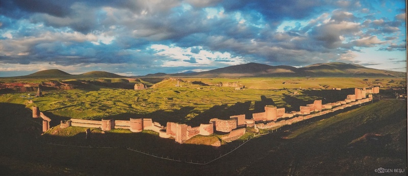
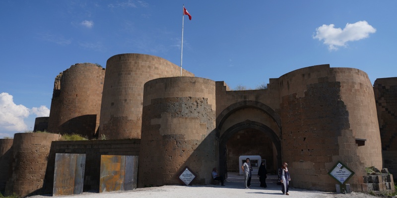
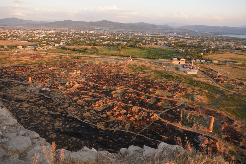
The impressive city walls encircling the entire city (except the section along the river) had been built for defence purpose. There are three gateways which are known as the Lion Gate, the Kars Gate and the Dvin Gate.
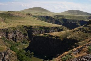
Today, the ruins spreading out in an expansive plateau above the river are atmospheric. All the structures were constructed using local volcanic basalt, a sort of tufa stone. We entered through the Lion Gate and followed a path to see the major monuments.
Church of the Redeemer. There is a fence around it and visitors are not supposed to enter. But someone has made an opening. When we saw people walking in the site, Kylie and I followed.
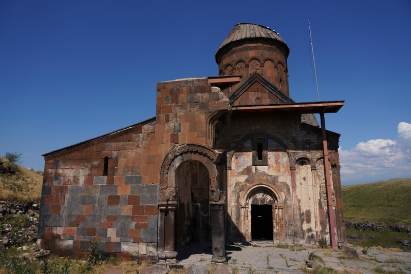
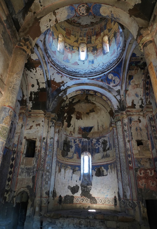 Church of St. Gregory of Tigran Honents (1215). Commissioned by a wealthy Armenian merchant Tigran Honents and built during the rule of the Zakarids, it is the best-preserved monument at Ani with beautiful frescoes on all sides of the church. There are two main themes of the series of the frescoes: the life of Jesus and Saint Gregory the Illuminator. There is also a scene from the life of St. Nino who converted the Georgians to Christianity.
The Cathedral (989-1001). It had been used as a Mosque before the grand mosque was completed. The interior is barren and in poor conditions. It is under renovation.
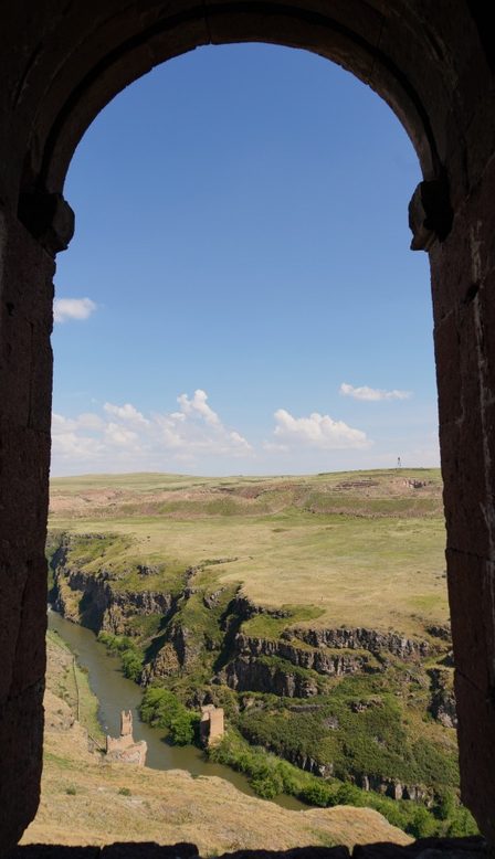
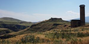
Manuche Mosque (13th century). From here, we had good views of the fortress, the river which forms the natural border, the gorge and the Church of St Elia perching on the top of the plateau at the end of the peninsula.
Caravanserai. The stone walls of the large houses are still standing.
Church of St. Gregory of the Abughamrents (late 10th century). This small church with a centralised plan with a dome over a drum, is probably a private chapel for the Pahlavuni family. The interior has six exedera.
Remains of a Fire temple.
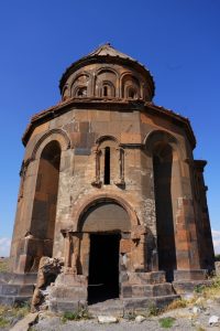 Sabahattin also pointed out the Church of Holy Apostles from a distance. This building had been turned into a caravanserai later. He gave us half an hour to wander on our own.
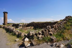 I looked at the remaining walls of a Georgian Church before heading to the Kars Gate. As it was closed, I had to return and leave from the Lion Gate.
Anyway, I think the site would be more atmospheric at sunrise or sunset. I would like to take a photo of the impressive city walls. But it is impossible. At the end, I took a photo of the city wall (taken by a drone) hung on the wall in the hotel restaurant.
We drove back to Kars which was the capital of the Bagratid kingdom from 928 to 961. Today, it has a population of about 100,000. Its border crossing to Armenia been closed since Karabakh region (inhabited mainly by Armenians) declared independence from Azerbaijan in 1991.
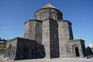 We visited the Cathedral of Kars, also known as the Holy Apostles Church. Built in the mid-10 century by the Armenian Bagratid King Abas I (r. 928-953), it was converted into a mosque in 1579. In the 19th and early 20th century, it became a Russian Orthodox and later Armenian cathedral. It became a museum in the 1960s-70s. In 1993, it was reverted to a mosque and is part of a larger Islamic complex that includes the Evliya Mosque, the biggest mosque in Kars.
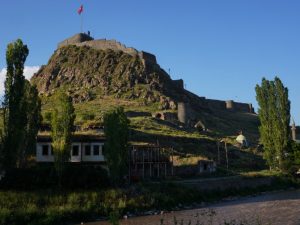
From here, we walked up to the imposing Kars Castle for a panoramic view of the city and surrounding area. Built in 1153, it was destroyed by Timur in 1386 and rebuilt by the Ottoman in 1579. The castle was hugely damaged after the occupation of the Russians after the Ottoman-Russian War of 1877-78. The walls of the castle were made of basalt masonry.
Sabahittin took us to a fish restaurant for dinner. We had grilled trout (not as fresh as those we had before). Our conversations suddenly turned to the duration of stay in Turkey for HKSAR passport holders. To my horror, I discovered our passports had not been returned to us when we left the Renaissance Hotel. Kylie and I were most anxious. Finally, we paid US$65 to a taxi driver to pick up our passports. The poor man drove a total of 400km and did not get back to Kars till 3 am in the morning!
Day 4 Saturday: Kars – Dogubeayzit – Van 170km
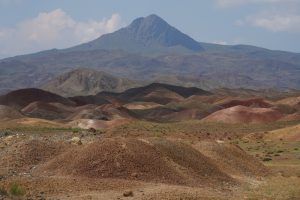 We spent the morning driving towards Dogubeayzit and passing by an area with rainbow coloured hills.
Today, we had our first sight of Mount Ararat which could be seen vaguely behind clouds. The Ararat massif is about 35km wide at ground base with two snow-capped and dormant volcanic peaks- Greater Ararat at 5,137m and Little Ararat at 3,896m above sea level. Mt. Ararat has been widely accepted in Christianity as the resting place of Noah’s Ark. It is the principal national symbol of Armenia and a sacred mountain by Armenians.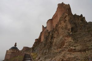
Sabahattin took us to a local restaurant to try a yogurt soup that is a specialty of the area. A healthy light lunch!
It was raining heavily. We did not rush and spent half an hour in a shop selling carpets and kilims made by local women. Kylie was interested in buying a small carpet. But the man was asking for an exorbitant sum of US$2,000 for a small silk carpet. We left.
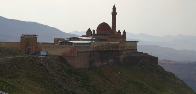
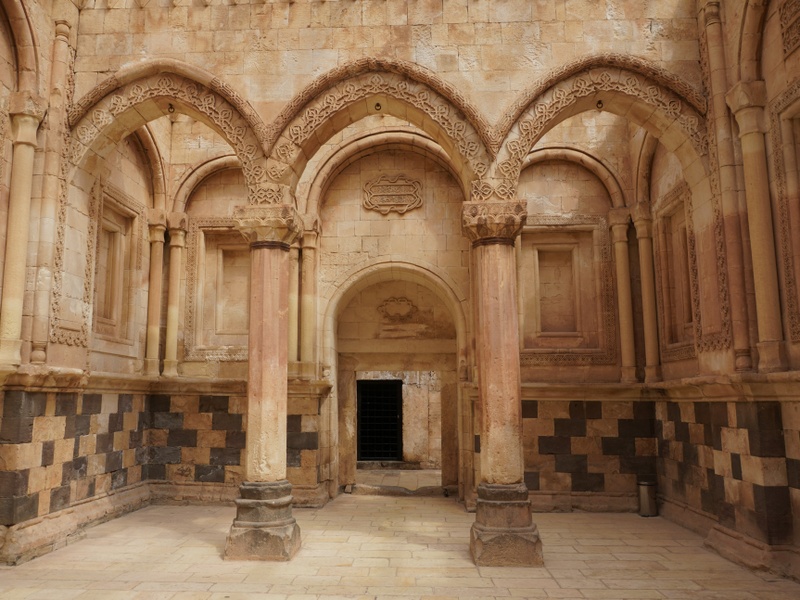
The rain almost stopped when we departed for the Ishak Pasha Palace, a complex situated on a rocky outcrop overlooking the Ararat plateau. Built by the semi – independent Kurdish Pasha Ishak and his son between 1685 and 1784, the palace complex is a unique fusion of architecture from Seljuk, Ottoman, Georgian, Armenian and Persian styles and an example of Seljuk revival with many Turkish elements. It is one of the few examples of surviving historical Turkish palaces.
The building occupies an area of 115m x 50m. The palace complex is divided in the traditional Ottoman manner into three sections- a service court, a selamik (or greeting) court with a mosque built with marble, a terrace and a beautifully carved dining hall and a haremlik (private) court. The palace section has two storeys with all its 366 rooms arranged on these two floors.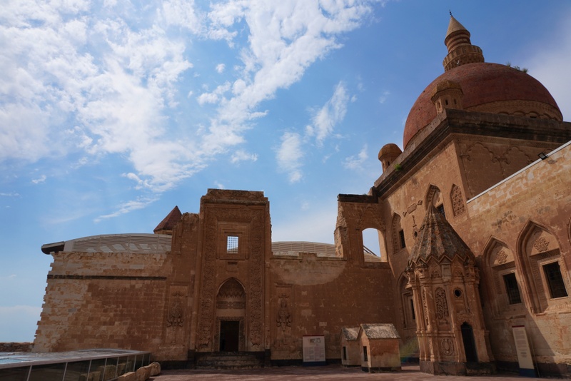
I like stone cut buildings which look solid and solemn. As the stone has a creamy light brown and gold hue, it looks elegant and grandiose especially the exquisite carving at the entrance to each section. It looks particularly striking and beautiful with sunshine and against a blue sky.
The Russian forces looted it several times in the 19th century. The huge gilded gold gates that adorned the palace are now at the entrance of the Hermitage Museum in St. Petersburgh.
By the time we left the complex, the sky had cleared up a bit. We stopped at a pass around 2,600m to take our last glimpse of Mt. Ararat.
We continued and then drove along the shore of Lake Van to reach the city of Van before 6pm. After dropping us off at the Ronesence Life Hotel, Sabahattin hurried home.
We had dinner at the hotel. I must say I much prefer to eat local food outside. We strolled for half an hour near the hotel but found nothing of interest.
Day 5 Sunday: Castles and Lake Van 170km
We felt like on holiday today: we stayed in the same hotel for two nights, did not need to pack and start late at 10 am.
Van (an elevation of 1730m) located on the eastern shore of Lake Van has a long history with many rulers. It has been a large city since the first millennium BC initially as Tushpa, the capital of the Urartu Kingdom (9th – 6th centuries BC) and later as the centre of the Armenian kingdom of Vaspurakan (908-1021).
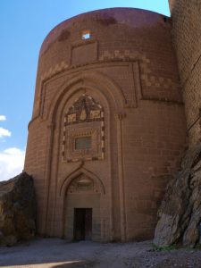 The old town of Van was burnt by Ottoman forces in 1915 as they retreated before the arrival of a Russian army. The modern city growing up 5 km inland from the lakeshore, has become a popular base for explorations of the region. On October 23, 2011, an earthquake with a magnitude of 7.1 in eastern Turkey near the city of Van killed 604, injured 4,152 and damaged over 11,000 buildings. Another earthquake happened on November 9 claimed 40 more lives and injured 260 people.
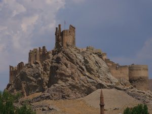
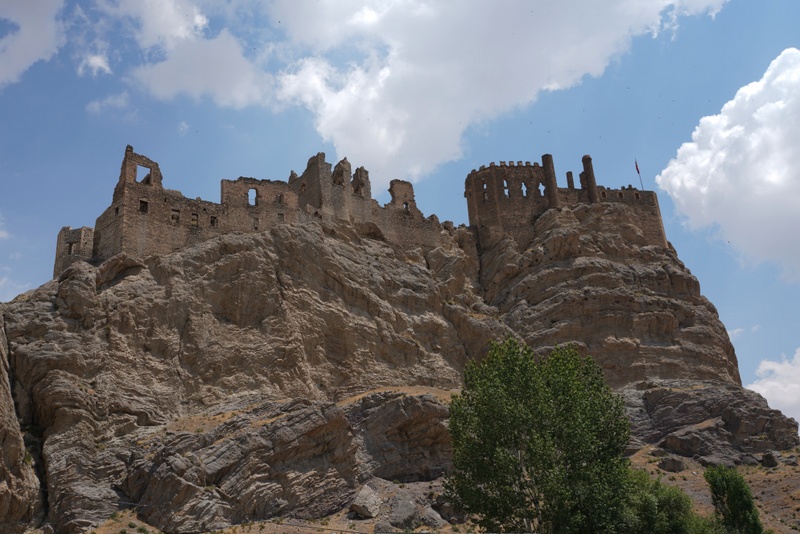
Sabahattin first took us to Hosap Fortress (33km southeast of Van). Apparently, a fortress had been built on an outcrop with commanding views of the area on the north bank of Hosap River since the days of the Urartu Kingdom. Straddling the Silk Road, the fortress had protected the route and was a point for charging tolls on travellers.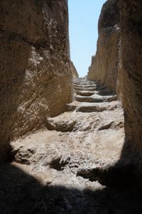
The structure we see today dates mostly from 1643 when Hosap’s governor Sari Suleyman Bey, a local Kurdish chieftain, rebuilt the castle and added a new entrance tower. The castle was damaged in two sieges by the Ottoman Governor General of Van in 1650s and 1839. The last major restoration work was carried out by the Turkish Ministry of Culture in 2011.
We strolled around the ruin which contains two parts. The palace/residential quarter behind high walls is closed.
We climbed and walked around the lower part which served as the administration quarter. Sabahattin pointed out an area which was once used as a dungeon for females. We could see the walls of a mosque of the palace from below.
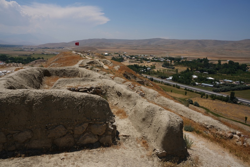
We headed back to Lake Van with a stop at the Urartian ruins at Cavustepe (25km from Van). Sitting on a ridge overlooking the plain below, this 2800-year-old ruins is even more interesting Hosap Castle. Sabahattin showed us the entrance and the steps to the castle.
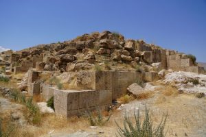 Though all buildings had gone, we could see heaps of stones and foundation of a temple, a sacrifice pit, rows of houses, water cistern, area for grain storage etc.
We enjoyed the commanding views of the fertile plain below. Before leaving, we met a 72-year-old man who is one of the 12 persons in the world who know the ancient language. He showed us his works inscribed on stones.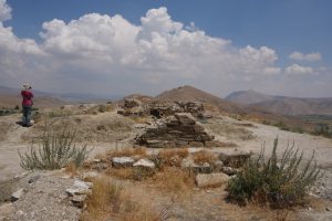
We drove almost an hour before arriving at a restaurant by Lake Van for lunch. We had a local fish Inci Kefal (pearl mullet) – the only fish that survives in salty waters of Lake Van for 90TL. The fish though not big with bones, is fresh and tasty.
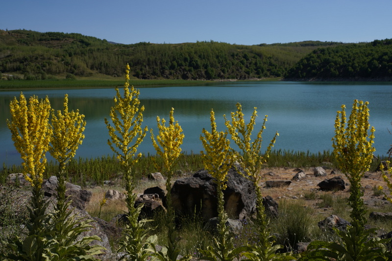
Lake Van is the largest lake in Turkey and the second largest in the Middle East. Located 1640m above sea level in the region of eastern Anatolia, Lake Van is a saline and soda lake receiving water from numerous small streams descending from the surrounding mountains.
 Measuring 119km across at its widest point with an area of 3,713 km2, it is one of the world’s largest endorheic lakes (having no outlet). The original outlet from the basin was blocked by an ancient volcanic eruption during the Pleistocene period when lava flows from Nemrut volcano blocked westward outflow towards the Mus Plain. Now dormant, Nemrut Dagi is close to the western shore of the lake while Mount Süphan (4058m) dominates the northern side of the lake. The lake has four islands each with a monastery.
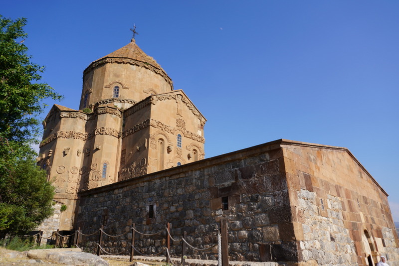
The most famous church and monastery is without doubt the 10th century Sourp Kharch (the Armenian Church of the Holy Cross) on the Akdamar Island.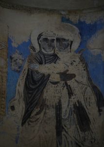
The complex built as part of a palace and religious complex between 915 and 921 by the Armenian King Gagik Ardzruni, is one of the best-known examples of Armenian architecture. It is famous for its reliefs and decorative features that adorn the exterior of the building and has been beautifully restored.
Several buildings were added later.
A chapel at the south eastern side dedicated to St. Stepanos was built in 1293.
Catholicos Zakarias (1296-1336) added a chapel at the north eastern side with a section in front of the chapel serving as an entrance.
Catholicos Tovmas (Thomas) built an addition at the front of the church producing a lower “split level” floor plan.
At the end of 18th century, a belfry was added over the southern entrance which partly obstructs view of some reliefs.
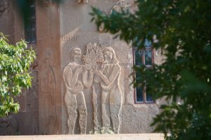 Sourp Khach was one of the only few Catholicosates (until 1916) that could hold the authority to consecrate bishops, elect church leaders and bless the holy oil that was essential for religious rites such as baptism, marriages, funerals and the anointing of bishops.
The church is now a museum but was opened to religious services for the first time since 1916 on September 19, 2010 led by the Armenian Bishop of the Holy Mother of God Armenian Cathedral from Istanbul. This event marking a significant milestone in the history of Sourp Khach, is now held annually.
I was glad to spend almost two hours at this unique and beautiful Armenian church soaking in the atmosphere. Most of the frescoes have gone though some paintings are still vaguely visible. But the stone carvings on the exterior walls each with different themes still look new and most exquisite.
We hopped on the ferry after 5 pm and drove back to Van to visit the Van Citadel/fortress, a massive stone fortification first built by the Urartu Kingdom during the 9th to 7th centuries BC and is the largest example of its kind.
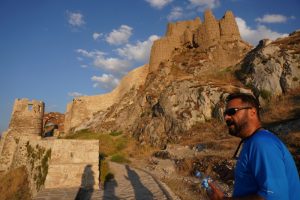 Successive groups including the Medes, Achaemenids, Armenia, Parthians, Romans, Sassanid Persians, Byzantines, Arabs, Seljuks, Safavids, Afsharids, Ottomans and Russians each controlled the fortress at one time or another. The fortress overlooking the ruins of Tushpa, the ancient Urartian capital on its left and Lake Van, is majestic and awesome. The lower parts of the walls were constructed of basalt (not-mortared) while the rest was built from mud-bricks.
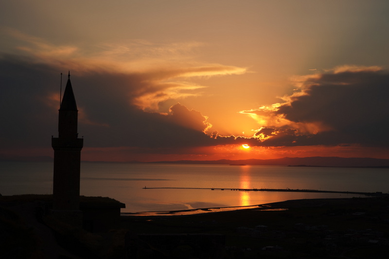
The citadel with high walls, a majestic entrance and a mosque, is a popular spot to watch sunset. I stood at the highest point behind the mosque and watched a most beautiful and atmospheric sunset.
We had a lovely dinner at Asayin, a family-run restaurant near the castle. I enjoyed the local specialities including mumbar (lamb intestine stfreuffed with rice), keletos (barley, nuts and meat) and perdepilavi (rice with chicken). We had a lovely and leisure day.
Day 6 Monday: Van – Tatvan – Mount Nemrut – Ahlat – Tatvan 300km
 We got up early and had an hour’s walk near the hotel. Many buildings in the city look new. I guess many have been built after the 2011 earthquake. We were happy to find the local bazaar. Though it was too early for the shops to open, men from the shops were gathering outside for breakfast. I looked at the large tray which had fresh bread, cheese, eggs, olive and salad with amusement and asked for their permission to take photos. A man invited me to join. I politely declined. When he offered me a piece of hot bread with cheese and tomato, I accepted with pleasure. The bread tasted much better than those we had in the hotel.
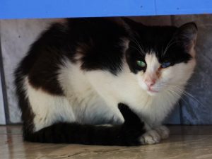 After Van, we would drive westward to reach our final destination in Gaziantep. We set off after 9:45 am and our first stop was a Cat House to see the unique cat of Van which eyes have two colours i.e. blue and yellow.
Sabahattin said out of 100 Van cats, only 17 would have eyes with two colours. These unique cats which were more abundant in the old days, are now protected. They can be seen either at the Cat House or the Van University.
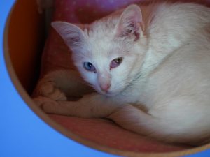 There is no entrance fee to the Cat House: visitors only pay 10TL for a can of food to feed the cats. I am not a fan of cats but find them cute, cool, intelligent and pretty.
There must be over 20-30 cats in the house. I had a lovely time watching these beautiful and unique cats. They all seem to be well-fed and -looked after. I watched how a mom licked her four new-born kittens which eyes were yet to be opened. Most of the cats have white fur. The only black one has most intrigue blue and yellow eyes. They all seem to have their own basket /territory. Two were sleeping in amazing positions.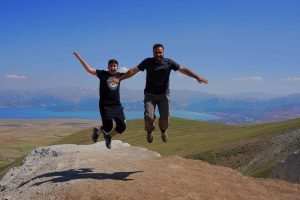
Then we drove to Sabahattin’s house to pick up Arda, his 14-year-old son who would join the trip. Arda is handsome and intelligent and always smiles. He is as tall as his father and speaks English well. We enjoy his company.
Our next stop was a carpet/kilim house. Kylie is good at bargaining: she eventually brought a nice wool carpet for US$200.
We arrived in Tatvan shortly after 1 pm. After leaving our luggage at the Crater Hotel by Lake Van, we went to a popular eatery nearby to have kebab. This shop roasts a few lambs in a traditional oven for five hours. The shop is closed in the late afternoon as soon as the meat is gone. I had a large plate of meat which was tasty but a bit dry.
After lunch, we drove to the Nemrut Mountain which rises above Tatvan on the southern western edge of Lake Van. The highest peak stands at 3050m above sea level and is one of the largest complete calderas in the world. The volcanic cone was believed to have originally been higher standing at 4450m before its eruption. The last eruption took place in 1440 BC.
There are five lakes within the crater. The largest two are the Cold Lake with an area of 13 km2 and an average depth of 100m and its deepest point is at 155m; and the Hot Lake with thermal springs. The heat may reach up to 60°C.
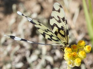
We had a lovely time strolling along the lake shore of the small Hot Lake. Arda has sharp eyes and excellent hearing. He told us a lot about cricket and dragonflies.
 We took photos and enjoyed the leisure stroll. Sabahattin took us to see the thermal springs.
Then we had a quick look at the Cold Lake which is not as picturesque.
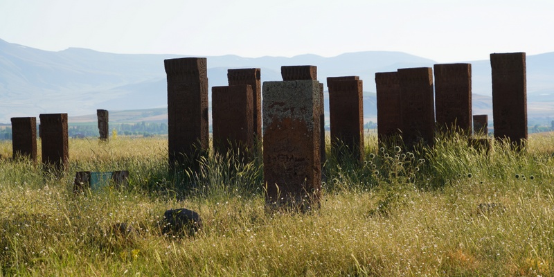
We followed an unpaved road to Ahlat to look at a large Seljuk cemetery with thousands of tombs. The tomb stones for ordinary people are simple. But those for important people such as royal families, nobles and religious leaders would have beautiful carvings and Arabian writing.
The setting sun created a fantastic setting for photography. Tomb stones on our right were glowing in a soft beautiful light. Those on the left side were in the shadow against a background of an expansive deserted field which was the battle field of one of the decisive battles for the Seljuks in the 11th century. It was atmospheric!
We stopped at a couple of tombs of Seljuk Kings before returning to Tatvan.
We went to a mall next to the hotel and had pasta and soup for dinner. Our nice dinner only cost 55TL. Then we had ice-cream in the hotel lobby. We only paid 4TL for a cone. The ice-cream was so nice that I had a second one!
We had a nice room with a view of Lake Van. I had a good sleep after a great day.

